Sargassum, explained.
The brown tide that can bury a Caribbean postcard: when the season runs, which coasts catch it worst, how resorts actually fight it, where the daily maps live — and the booking strategies that dodge most of it.
No single factor has rearranged Caribbean holiday planning in the last decade like sargassum — the floating brown seaweed that arrives in rafts, piles onto windward beaches in rotting drifts, and turns turquoise postcards the colour of stewed tea. Some weeks it's nothing; some weeks it buries resorts' entire beachfronts. The difference between a ruined week and an untouched one is mostly geography and season, both knowable in advance — which is what this explainer is for.
What it is and when it comes
Sargassum is open-ocean algae — historically confined to the Sargasso Sea, but since 2011 blooming each year in a vast "Great Atlantic Sargassum Belt" between Africa and the Americas, fed by warmer water and nutrient runoff. Currents conveyor the rafts west into the Caribbean each spring. The season runs roughly May through October, peaking June–August, then fades through autumn; December through April is reliably the clean window — which conveniently matches the region's dry season anyway. Year-to-year volume swings enormously: some summers are mild, some break records, and forecasts firm up only weeks ahead.
The geography that decides everything
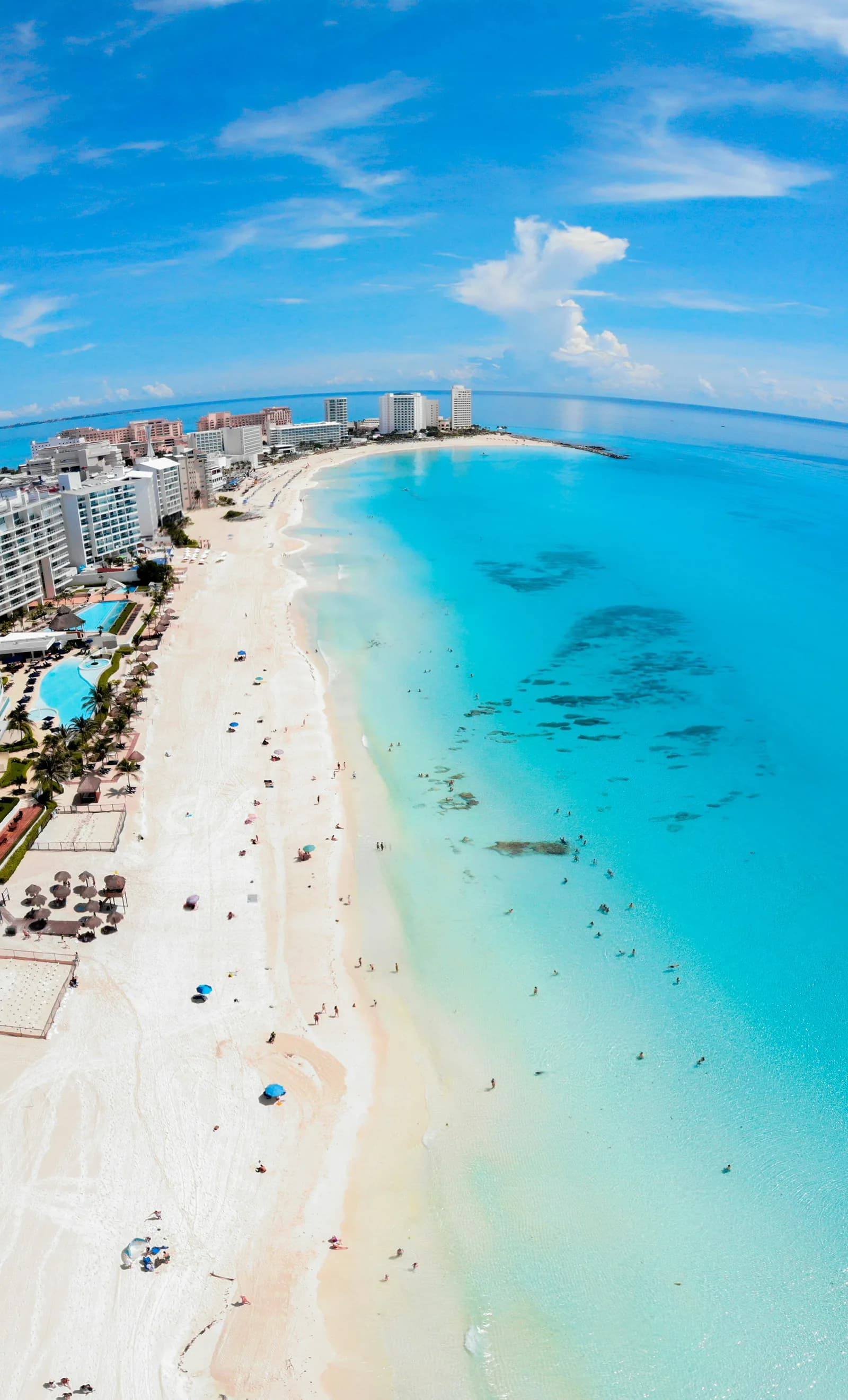
Sargassum arrives on the prevailing easterlies, so east-facing windward coasts catch it; sheltered and leeward coasts mostly don't. Applied to the destinations we cover:
- Cancún and the Riviera Maya: the long east-facing strip (Playa del Carmen, Tulum) is the belt's most famous victim in season; Cancún's north-facing hotel-zone arm and Isla Mujeres' Playa Norte shrug most of it off. Cozumel's west coast stays calm. And the peninsula's killer feature — the cenotes — couldn't care less, which is why summer Yucatán itineraries lean inland.
- Punta Cana: east-facing Bávaro and Uvero Alto take seasonal hits (the house line stands: mid-September is a hurricane gamble with sargassum on top); the south-facing Cap Cana pocket and west-facing excursion islands (Saona's lee) fare better.
- Barbados: the east and south-east catch it; the west-coast "platinum" beaches usually stay clear.
- The ABC islands (Aruba): largely outside the main conveyor — one reason summer Aruba keeps appearing in our July–August lists.
What resorts can and can't do
The big properties run dawn beach-cleaning crews, barriers and even harvesting barges — on a moderate day they keep their frontage genuinely usable. What nobody can fix: a record influx week (machines lose to physics), the smell of decomposing drifts beyond the raked zone (hydrogen sulphide — unpleasant, briefly), and brown water in the swim zone itself. Mild skin irritation from swimming through thick mats is real; clear-water days are unaffected.
The booking strategy, concretely
Travelling December–April: ignore all of this; it's not your problem. Travelling May–October: book the sheltered geography above rather than hoping; favour resorts with big pool estates as the hedge; and check the daily maps before committing beach days — the University of South Florida's satellite outlook tracks the belt monthly, and local networks (Red de Monitoreo del Sargazo for the Mexican coast) post beach-by-beach conditions every morning. A ten-minute check the week before departure tells you more than any brochure ever will. And if the maps look grim and your dates can't move — the cenote-and-culture inland version of the Yucatán is genuinely the better holiday that month anyway.